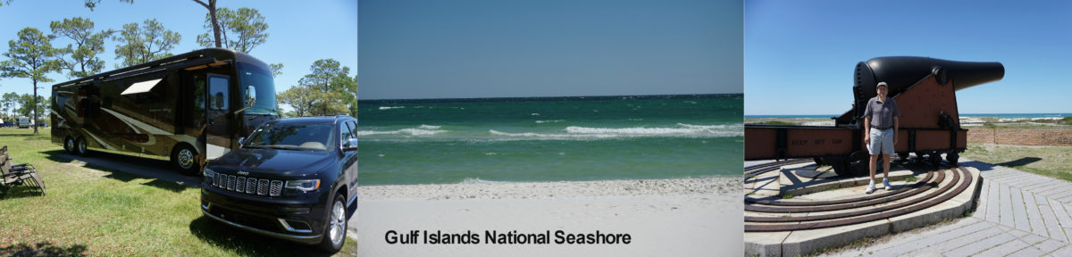
On Sunday, September 17, we left West Yellowstone a little after 11:00 and arrived in Billings, Montana a little after 3:00, with the odometer reading 8897, about 240 miles. The route took us north on route 191, a scenic two-lane road that took us through Yellowstone Park for about 20 miles, and then on to Interstate 90. As we travelled on I-90, the scenery changed from mountainous to grasslands, with a whole lot of empty space out there. Our campground in Billings was the Billings Holiday KOA, which is quite close to I-90. It was a pleasant and well-run KOA, with some stuff that looked like it would have been entertaining for families with kids.

We were only staying overnight on the way to Rapid City, South Dakota, but we still hoped to find something interesting to do since we got in relatively early. But because it was Sunday, most of the things Therese found on her phone (using the TripAdvisor app) were closed for the day, or at least closed early, so we just hung around the site and “camped”.
We finished watching the 2011 HBO series “Luck” with Dustin Hoffman and some other pretty famous actors. We enjoyed the series, but I can’t recommend it all that highly because it was clearly meant to continue beyond one season, so you don’t get satisfactory resolution of some of the subplots. The series revolved around the Santa Anita racetrack, which is in California, about five miles from where Therese grew up. We later discovered that it was cancelled because three horses died during the filming – two during Season 1, and one early in the filming of Season 2, at which point the producers pulled the plug.
We had hoped to go outside and see the big night sky in Montana, but the campground was lit up like a Christmas tree and after looking for a while, we decided it wasn’t worth staying out in the cold (about 40 degrees) with no hope of seeing the night sky free of interference.
On Monday (September 18), we got off to a leisurely 10:00 start, and arrived at Hart Ranch RV Resort in Rapid City, South Dakota just after 5:00 with the odometer reading 9287, about 390 miles. Hart Ranch is a large membership RV park. I am not exactly sure how they work it, but you apparently get very low rates if you are member, but they also take non-members in the off-season, such as now. It has lots of amenities like a pool, tennis and pickleball courts, and a restaurant.

Not particularly bright and early, we got up on Monday and headed to our first stop in the Black Hills area, Mount Rushmore. Both Therese and I had been there before, approximately 40 years ago. The visitor facilities have been vastly upgraded since then, to accommodate the >2,000,000 visitors they get each year.


We enjoyed the Presidents Walk, which gives a variety of viewing angles for the monuments and explains the choices of subjects Washington, Jefferson, Lincoln, and Teddy Roosevelt.

We also thoroughly enjoyed the visitors center’s exhibits about the sculptor in charge, Gutzon Borglum, who was quite a character.

In the “sculptors studio” there was a ranger talk about the 1:12 scale model of the mountain, and details about the method of carving.

90% of the 450,000 tons of granite that was removed was done so with dynamite (the original plan was to do it all without any explosives, but that quickly went by the wayside when they determined that quite a bit of rock had to be removed to get to the stable rock they wanted – 30 feet for Washington’s face and up to 75 feet for Roosevelt.

The history of the project included quite a bit of controversy, including the subject (it was originally envisioned as western, rather than national heroes), and whether it should be built at all. There was an anti-sculptor contingent that thought that the Black Hills granite was just fine as nature created it, with no need for man-made “improvements”. But the contingent that wanted to give tourists a reason to come to South Dakota won out, and now the whole Rapid City area (which has an abundance of nature-provided attractions) has a bit of a tourist-trap feeling to it, with dinosaur museums, reptile farms, bear country, gold mines, helicopter tours, jeep rides, etc.
At about 1:00, we ate lunch and then headed to the South Dakota Air and Space Museum, which is at Ellsworth Air Force Base, right off I-90.

They have about 20 planes parked outside, including some huge bombers – a B-52 and a B-1B, as well as some fighters and trainers. I wish they had some information about each airplane – they didn’t even have their types indicated anywhere. Maybe there was a map with locations and information, but if so we didn’t find it, so what is below is my best guess.


While we were looking at the airplanes, Therese noticed a B-1B coming in for a landing, and I was able to get a few pictures of it. It would have been cool to see one of those monsters taking off.


Inside there were lots of informative exhibits about the Ellsworth Air Force base and its history and mission (a lot of which had to do with America’s nuclear deterrent, which as you will see is a big theme in this area). The picture below is of a nuclear missile carried by bombers that was part of that nuclear arsenal.

There was a simulator for the B1-B, for the Offensive Weapons Officer and Defensive Weapons Officer positions. The electronics were probably state of the art in the mid-1980’s when the B1-B’s were built, but they look pretty primitive by modern standards.

There were a lot of other historical exhibits there, too – some of focusing on the post World War II period, including the Berlin wall and the Berlin airlift, and a lot of information about the Korean war. This was another museum that you could easily spend a whole day in and not see it all. But about 4:30, we used up our quota of information for the day and headed home. Our intention had been to go back to Mount Rushmore for the nightly lighting ceremony, but it was rainy, cold, and windy, so we decided that we couldn’t risk it, and would try again another night.
On Tuesday, we got going (not particularly early, again) and headed for the Badlands, which was about 90 minutes east of the Rapid City on I-90. The Badlands is one of the sights that I remember from my previous trips across the country. It is a landscape of highly eroded Pierre Shale that rises abruptly from the surrounding prairie. We stopped at the Ben Riefel Visitor Center at the east end of the park to learn more about the geology and (as usual) we watched the film that covered the geology (the whole area was once a huge inland sea), fossils, and wildlife that is found in the park. The exhibits were also interesting, including some info about how they are successfully reintroducing some endangered species into the park.
A short distance from the visitor’s center is a parking area where we took the Notch Trail, that leads about a mile up into some of the weird rock formations that make up the park.

The trail had a few steeper sections, including one where they put up a timber and cable ladder to get up a 30-foot rise. That was pretty interesting.


From there, we drove along the Badlands Loop Road, which has many overlook areas to see both the park and the wildlife. We saw some bison, bighorn sheep, and a huge colony of prairie dogs.


The rock formations are strange, inhospitable, and delicate looking (and indeed, the museum said that there had been erosion of about a foot in the last 70 years, as compared to the granite at Mount Rushmore which erodes at about one inch per 10,000 years).


The weather was picture perfect – about 70 degrees with a breeze and an unbelievably blue sky.

At the end of the approximately 30 mile road, which isn’t a loop at all, we were at the northern Pinnacles gate, which we took to get back up to I-90 to again head east to the same exit as we took for the Badlands. This time we went north from the exit about ¼ mile to the Minuteman Missile National Historic Site, arriving at 2:45.

This consists of a museum and two decommissioned nuclear missile silos. Unfortunately, the closer of the two silos was closed to install a new fire suppression system, and the other 15 mile distant silo closed at 3:00, so we couldn’t make it in time. But the museum was actually fascinating. The roughly 60 mile square area northeast of Rapid City area was one of the sites where the U.S.’s land-based ICBM nuclear deterrent was based.

As you can imagine, this was controversial (although I don’t think the locals had much choice in the matter). It definitely brought economic activity and vastly improved infrastructure to the area, but at the cost of being a prime target for Soviet missiles. The exhibits at the museum told a year-by-year story of the cold war – the significant events and a graphical representation of the number of missiles that the US and Soviets each aimed at the other, as well as the historic proliferation of nuclear-capable countries. There was also a display listing the “close calls”, both from provocations like the Berlin blockade and the Cuban Missile Crisis, and false warnings due to failures of the detection systems of both the US and Soviets. The life of the “missileers” as the Air Force personnel manning the silos and control centers are known was also covered by some of the exhibits. The Minuteman II missiles that occupied 450 silos in South Dakota were all decommissioned in the ‘90s in accordance with the START treaties that were signed after the cold war thawed out, but there are still some Minuteman III missiles in the area. These have smaller warheads and only one per missile, unlike the larger, MIRVed Minuteman II warheads. After a fascinating 90 minutes at the museum, we headed back to the campground.
After dinner at the campground restaurant (not highly recommended), we left for the lighting ceremony at Mount Rushmore.
By the time the lighting ceremony started (about 8:00), the temperature had dropped to about 50 degrees and there was a bit of a breeze, so we were glad we had dressed warmly. One of the visitor facility improvements is a very large amphitheater that seats 2500. It’s probably full in the summer, but I’d say there were about 800 there on this Wednesday in September. After a short presentation by one of the park rangers (the centerpiece of was Lincoln’s Gettysburg address), they showed a short movie that explained the rationale for each of the presidents on Mount Rushmore. Then they lit up the statues (one of the exhibits we had earlier read said the lighting was all new sometime in the early 2000’s, I think). They then called all the active and retired military in attendance up to the stage for a round of applause and thanks. It’s definitely worth going to if you get a chance. I tried a bunch of different camera to get a decent photo of the lighted sculptures, this one is the best I got.

We had decided on Tuesday to extend our stay for another day so we could visit Custer State Park, which we did on Thursday, September 21. Wow, South Dakota knows how to put together a State Park.

The visitor center looks like it is brand new, with a bunch of exhibits, mostly about the wildlife (Bison, elk, pronghorns, bighorn sheep, prairie dogs and burros). They have a movie theater that knocked all the National Park movie theaters into a cocked hat – a huge screen and exceptionally comfortable seats. Unfortunately, they were having technical difficulties with the equipment and had to cancel the 10:30 show. We didn’t want to wait around another half-hour, so we headed out into the 70,000 acre park. From the visitor center we took the 20-mile Wildlife Loop Road. On the road, we saw all of the promised species except elk.

The park has a herd of about 1450 bison. An exhibit in the visitors center said that the entire North American population was only about 1000 in the late 1800’s, down from tens of millions before Europeans came to America. It is hard to believe that anyone could be so stupid as to squander a resource like that, but there you have it.

The Wildlife Loop Road ends at Route 87, which, after you follow it for about 10 miles, turns into the Needles Highway, a winding, narrow, spectacularly scenic road through the needle-like granite formations that give it its name. The route was laid out by foot and horseback by former South Dakota Governor Peter Norbeck, and then engineered by Scovel Johnson. It was built (requiring 150,000 pounds of dynamite), and finished in 1922.
The weather was perfect again, and the scenery was spectacular. We stopped for lunch at the Heddy Draw picnic area, which also had a very nice short hike up the ridge of a hill.

We stopped to just look out over the Needles on the William “Bill” Trapp memorial bench halfway up. Bill was born in 1948 and died in 1996, so he only lived 48 years, but I hope he got a chance to enjoy the view from somewhere near where his memorial bench is located, absolutely awesome.

Therese is, for reasons unknown, unable to pass by a site where anyone has built a cairn, no matter how half-baked, without adding an additional stone. Here she is, at it again.

There are two narrow, low tunnels on the route, the Iron Creek Tunnel and the longer Needles Eye Tunnel, which are about 8 ½ foot wide. Very interesting to drive through. In between are more spectacular views of the Needles.


At the north end of the park is the Sylvan Lake area. We stopped there and did the one-mile loop trail around the lake, which turned out to be more interesting than we had expected.


All through South Dakota, there have been millions of butterflies. Maybe they are on some kind of migration or something, but they are literally everywhere. Unfortunately, several thousand were wiped out by the big flat front of the Dutch Star, which excels at killing them. They seem to mostly miss the Jeep windshield, because it has a slope to it. I finally got a picture of one so perhaps someone out there can identify the specie of butterfly.

You could easily spend a week or more in Custer State Park. They have all kinds of things to do. A week after we were there is the annual Buffalo Roundup, where they bring in cowboys and cowgirls to herd the Buffalo from horseback, and then have an auction to sell off some of the herd so that the size of the herd matches the predicted forage for the following year. It is apparently quite an event, drawing a large show and including an art show in the mix.
Tomorrow, we are moving on. We’ll let you know where in the next post!