With about 340 miles ahead of us, we got off to a reasonably early start at 8:20. It was about 49 degrees when we got going, and it stayed cold, with a few clouds but not much wind. To get to Moab, Utah from Holbrook, Arizona (at least in an unwieldy big rig, there are probably more direct car routes), you first backtrack east on I-40 to Gallup, New Mexico, and then take Route 491 north through New Mexico, through Colorado for a while, then into Utah, and then you turn on Route 191 to Moab. You pass within 20 miles of “four corners” the only place in the country where four states meet – Arizona, New Mexico, Colorado and Utah. We didn’t feel the need to take the side trip to the actual four corners monument, since the drive went through each of those states.
Most of the drive is in New Mexico, through desert landscape broken up by some huge rock mesas and peaks (you are never very far from sights that would knock your socks off if you saw them in isolation; you just get used to them as part of the background in the high desert).


As we went north, we crossed into the Navajo Nation, which is a large reservation. Things looked pretty bleak there – most of the sparse residences we saw were trailers, many of them boarded up and abandoned-looking. It looked even drier there than the other parts of New Mexico we had previously seen.
For some reason, once you cross into Colorado, things seem to get wetter, greener and more prosperous looking. There are even some wheat fields and other farming going on. High mountains (12,000’ plus) are visible in the background, complete with snow. It got progressively colder, and there was rain visible both to the east and west of our route. We started the day at about 5000’ feet at Holbrook, climbed as high as 7200’ in Monticello, Utah, and then ended up at about 4500’ at our destination. In Monticello, we hit some kind of cold spot where the temperature was briefly down to 32 degrees, and we even drove through some snow for about 5 minutes (we took a picture, but unfortunately it didn’t come out). There was snow on the ground for about 40 miles in that vicinity, so it must have snowed for real the previous night.
For the first time, we fueled up (out of necessity) at a regular gas station rather than a truck stop. In hindsight, we should have filled up while we were on I-40, but we still had a half tank there, so we didn’t. Route 491 was four lanes for a while (but with so little traffic, I don’t see how that was justified), but then went down to two lanes. We thought we’d find a real truck stop in Cortez, Colorado, but no such luck. Since we were down below ¼ tank, we decided “any port in a storm” and spotted a gas station that had diesel that looked like we could get through. The drawbacks were that it was a potholed muddy mess, and that unlike truck stops, the pump delivery was car speed rather than truck speed, and it capped a credit card purchase at $95. So it took about 10 minutes to fill up, I had to feed it my credit card twice, the rig and the Jeep got muddy, and it was about 40 degrees. But it beat running out of fuel. After we got there, I bought a new app for my iPad – AllStays/Truck & Travel that’s a truck stop guide.
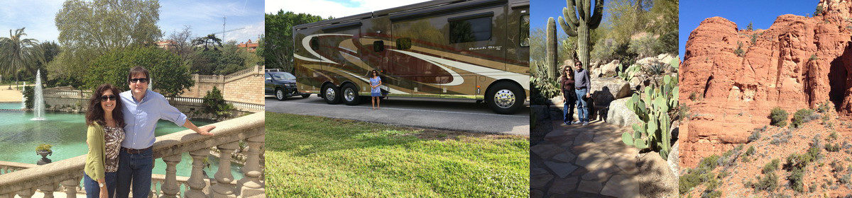
When we finally pulled into the campground (odometer reading 4734, making it a 337 mile day) , it was 3:45 or so. Moab is in Mountain Time Zone, and it looks like they do recognize Daylight Savings Time, so we lost an hour coming from Arizona, and our elapsed time was a little more than 6 hours. One advantage of travelling in relative cold weather was obvious from the windshield of the DutchStar – almost zero bugs. I’m not sure what temperature they operate at, but they definitely aren’t out there when it’s below 50 degrees.
Since we hadn’t found a decent place to stop for lunch, Therese made an early dinner as soon as we got set up.

We are staying at Spanish Trails RV Park. It has some grass and some trees, and the sites aren’t overly squashed together. But 2/3 of the other campers seem to have come to the area to tear up Mother Nature with four wheelers (aka UTVs), so there is the constant sound of those things scooting around. The RV of choice here seems to be a “toy hauler” fifth wheeler, which is towed by a hitch in the bed of a pickup truck, and has a combination ramp/door in the back into which you load your UTV for transport.
After dinner, we took a ride to the town of Moab, which is about 3 miles further on Route 191. To our surprise, it’s quite a happening place. It’s in a valley between a high plateau on one side and mountains on the other, right on the Colorado River. They must use water from the river to irrigate, because it is a green oasis in this arid area. There were all kinds of restaurants and shops, and many adventure tour places (river tours, jeep tours, UTV tours, etc.) Further on, the Arches National Park was on the right, and the high plateau continued on the left. Everywhere you look there was spectacular scenery.
About 15 miles north of the town is the Canyonlands Field Airport. We pulled in to see what we could see. There was nobody there, but the FBO / terminal for air tours, etc. was wide open. I guessed the gate security code (the CTAF, for you pilots out there), so we were able to walk out on the ramp and take a quick look at the parked airplanes. There is a company that operates helicopter tours out of the airport, and I was briefly interested until I discovered that their helicopter is a Robinson 400, and there’s no way you’re getting me up in a piston helicopter in that terrain.
Therese, upon reading the National Park book that we brought with us, discovered that Arches is one of the most popular National Parks. So, we resolved to get going earlier, and we headed out at 7:30. It was a bit nippy when we stared out, about 43 degrees, with a few clouds, remarkable visibility and a light breeze. The park opens at 7:00, and there was already a continuous stream of vehicles headed in. There was no line at that time, but that was probably due to the fact that nobody was manning the gate, so everyone just rolled in for free. Our America the Beautiful pass would have gotten us in free anyway, so we didn’t feel bad.
First stop was “Park Avenue” so named because it is a fairly narrow canyon with impressive, building-like sandstone edifices on either side. We took a 1.5 mile hike down into it and back, accompanied by about 50 cheerful French tourists from a tour bus that arrived just minutes after us. We encountered them (or other French tourists from other tour buses) pretty much all day. The steep, high cliffs rising above the relative flat floor of the “avenue” is really impressive.


We continued on to Balanced Rock, careful to walk softly to avoid having it fall on our watch.

Then, we went on to our first view of actual arches – Double Arches, in the Windows section of the park. Here, a half-mile hike gets you to both North and South Arch. By this time, it was getting more difficult to find a parking space at the points of interest, but we managed.

Next stop was the Delicate Arch. We again managed to get a parking space, but it was one of very few open in a lot that has more than 100 spaces. Here we took our most strenuous hike of the day – 1.5 mile each way, with substantial elevation change and some scary (for height pansies, anyway) sections along a cliff – brought us to within a few hundred yards of the arch. This must be the one of the most popular sites in the park, because there were literally hundreds of people making this hike. The scenery all along the trail is spectacular, including the 12,000 foot mountains in the distance. In the morning when we were at Arches, the clouds obscured the peaks, but later in the day they were visible.


Along the path, there was an exciting opportunity to take a side trail to see yet more Petroglyphs!

The crowds were detracting from the experience, and we knew that we weren’t far from the end of the currently-accessible part of the park (road work has closed the northernmost part of it), so about 11:30 Therese called one of her famous audibles to leave Arches and head for Canyonland National Park. On our way out of Arches, we passed a line of about 100 cars waiting to get in – glad we missed that!
There are two separately-accessible portions of Canyonland NP – the Needles area to the south, and the Island in the Sky area about 25 miles north of Arches. We headed to the Island in the Sky area, which was closer for us, and more automobile accessible anyway.
Canyonlands is a more remote park, and has more areas for real hikers, mountain bikers, and campers to enjoy the real western nature that surrounds you there. But for us wimps, the car-accessible part of it is absolutely spectacular. You cannot begin to capture the grandiosity of the landscape in a photograph, although we did try. (I am only including a few of the pictures we took since the WiFi at Spanish Trails RV Park is, as far as I can tell, totally nonfunctional so I am having to use my iPad Wifi hotspot, giving Verizon a shot at ripping me off for bandwidth usage.)
Canyonlands was busy, but not the three-ring circus of Arches. We had no problems finding a place to park in any of the much smaller overlook parking areas. I would estimate that there were no more than 5% as many visitors as Arches.
Our first stop, just inside the park, was Shafer Canyon Overlook. You don’t get much of a look at the canyons driving up to the park, or on the road before Shafer Canyon, so taking the short walk to the overlook point is a real “wow!” moment. You’re up on a cliff that must be 500 feet high, looking down at a huge canyon. Unexpectedly spectacular.


From there, we went to the Green River Overlook, where you can see one of the rivers responsible for the canyons – the Green River (the other is the Colorado). I think the “Green” name must have come from the trees (real trees, not the pygmy junipers that grow in the rest of the park) along its banks. It is similarly awe-inspiring.

Next stop was Upheaval Dome, a large rock thrust up out of the ground. A walk of about a mile reveals a large crater that is either meteoric or volcanic in origin (it seems the origin is still in debate).

Then, the Buck Canyon Overlook (more of the unbelievable vistas), and finally Grand View Overlook, where the French tour bus caught up with us to provide them and us a panoramic view of buttes, mesas, plateaus, canyons, and mountains. By the time we finished taking in that sight, it was nearly 4:00, so we called it a day and took the scenic drive back “home”.

Most of the day was in the low 50’s, but when we got back to Spanish Trails RV Park, it warmed up to the low 60’s, so we ate outdoors for only the second time on the trip. Still no bugs!
If you want my recommendation when visiting Moab, Utah, do not miss Canyonland. Arches is a nice stop, too (get there as early as you can), but Canyonland is a must-see bucket list item.
John and I are leaving Tues for a similar adventure. This will be our 3rd visit to the Western NP’S, only this time with adults only. I can’t wait to see the beautiful sites you are experiencing. Also, you are helping me with what to pack. The temps there are a lot cooler than I expected, so layering is a good idea. Temps here (Wynnewood) have been in the 90’s- our 1st heat wave, so I am waiting for this weekend cool-down to pack.
Thanks for sharing your adventure. “Westward Ho” !
http://www.travelpod.com/travel-blog-entries/videoray.ag/1/1379928072/tpod.html shows what we did 4 years ago tearing up nature in Utah
Your pictures & narrative are fascinating!! Think in future retirement, being a tour guide would be fitting, Barry. You are both getting lots of exercise on these hikes so no need for a gym in the Dutch Star! Did Therese get a keyboard so you could have beautiful music too? Look forward to each of your travelogues. Keep safe and enjoy. You aren’t missing much here in PA. Cheers! Pat
So glad that you made it to Arches and Canyonland! Knew you would love it.
We had our adventures last week during the filming at our house of the first episode of a new Amazon TV series to air next March. It stars John Krasinsky as Jack Ryan and Abby Cornish as his girlfriend. We will send you some pictures. Love your posts.