With an easy 270 mile drive scheduled for Saturday, we got up at a reasonable hour. Therese made a quick trip to the grocery store while I “broke camp”, and we hit the open road at about 9:30.
We headed north on Route 191 to Interstate 70, where we headed west. The view all around was the incredible desert scenery we have gotten used to. As Therese remarked – you don’t really have to go to the National Parks to see amazing stuff, just drive around out west and there it is. Just after we got onto I-70, we saw a sign near an exit that said “Last services for 110 miles”. They weren’t kidding – there is absolutely nothing on that stretch of road – there were some stretches of 20 miles or more where there wasn’t a dwelling of any kind in sight.

The road is in perfect shape, the speed limit is 80, traffic was extremely light, and there was no sign of law enforcement, so it must be tempting for locals who travel that road regularly to see if they can average 100+. I’d have been tempted if I was driving a regular car instead of the big rig, except of course that it is well known that I am a scrupulous observer of speed limits. Instead we trundled along at the usual 65, except when we got to the prodigious hills. One 5% uphill grade of about 7 miles slowed the Dutch Star to about 45 mph at the steepest parts, but it showed no signs of overheating or other distress – it just downshifted to 4th (out of 6) and chugged on up to the summit, which was labelled as 7886 feet. The few trucks on the road were travelling about the same speed. The Dutch Star’s Cummins engine is turbocharged, so it is not very sensitive to altitude. A normally aspirated engine starts to lose quite a bit of power at those altitudes. On the corresponding downhills, I was glad we had the engine compression brake so we didn’t have to use the service brakes to keep our speed down.
From I-70, we took Route 89 south towards Bryce Canyon. The first few miles are kind of winding, but then it straightens out. It follows the Sevier River for quite a while, so there is some actual green trees near the river and some green fields that are irrigated. There was little traffic there, also so it was a pleasant drive.
As we got closer, we stopped in Panguich to fuel up – just under 7 mpg from all the hills. From there, it was about a half hour to Ruby’s Inn RV Park and Campground, about a mile from the entrance to Bryce Canyon National Park. Everything along that stretch is “Ruby’s” this, that, or the other thing – hotel, general store, restaurant. Therese read in the campground pamphlet that Ruby was actually Reuben Syrett, and he bought the land in the area in 1916 with the intention of ranching. Shortly thereafter, he heard about Bryce Canyon, went to see it, and decided to promote it and get into the tourist business rather than ranching. When we stopped for the day, it was about 3:00, and the odometer read 5011.
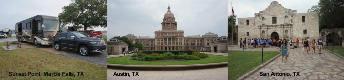
The park is large, and our campsite was the very last one – 242. It’s in a newer section where the trees haven’t really had a chance to grow very much. The older section is actually more pleasant, but our site was nice enough for our purposes. Our elevation is 7650 feet, by far the highest we have stayed at.

Therese, having consulted her TripAdvisor app, discovered a favorably reviewed restaurant, Stone Hearth Grill, just outside a town called Tropic about fifteen miles away. She had made dinner reservations before we left Moab, so we headed over there at 6:00. We had just finished ordering when in walked Harry Vitelli and his wife, Helen! Harry is a friend from work – he’s Senior Vice President of our Project Delivery division. It turns out that they were staying in the inn associated with the restaurant, celebrating their 30th wedding anniversary. How’s that for “it’s a small world” type of coincidence? The restaurant was able to consolidate us into a table for four, and we had a delightful outdoor dinner with a view of Bryce, talking about our trip and their experiences in the area for the past few days. Harry recommended the “AllTrails” iPhone app, and told us about the Willis Creek trail that we took the next day (more on that later).
Sunday morning, we finally got rolling about 9:00. It was still about 45 degrees, having been down to 30 overnight. We knew Bryce was a popular park, and had read that there was a shuttle bus that they suggested visitors take to ease traffic congestion in the park. Being good citizens, we decided to do that, assuming that it would make it more pleasant dealing with the crowds. There was a convenient “park and ride” parking lot just across the street from the RV park, so off we went.
We stopped first at the visitor center, where we saw a 25-minute movie about the park. In every other park, those have been spectacular, but here they seem to be recycling a movie from the 90’s. The content was interesting, but the resolution was nowhere near what everyone has come to expect with high-def TV. They really need to reshoot it and project it with modern gear.
We walked from there to Sunrise Point, which showcases what we learned in the movie – Bryce Canyon Park has scenery that is unique in the world. There are “hoodoos”, thin spires of eroded rock, everywhere you look. They are red rock, usually capped with a harder white rock. When the white rock dissolves from the top, the much softer red part erodes rapidly (in geologic terms). So the park looks somewhat like I imagine the Arches formations will look like in a few million years.


From Sunrise Point, it’s an easy half-mile walk to Sunset Point, with equally bizarre and spectacular vistas. The viewpoint is from the top of the canyon looking down into the dizzying depth.

Unfortunately, most of the other tourists appear to ignore the advice to leave the car behind and take the shuttle bus, and the tour buses, of which there are many, definitely do. So while the experience of the scenery was (as expected) spectacular, there was an enormous crowd of tourists, most of whom seemed more intent on taking pictures of each other (and themselves with selfie sticks) than actually enjoying the scenery. I read (on the internet, of course) that 2.5 quintillion (10 to the 18th) bytes of data are now being created daily. Let’s estimate how many of those were authored in Bryce today. According to Wikipedia, 2,365,110 tourists visited Bryce in 2016, roughly 6500 per day. But there are very few in the winter, so suppose there were 15,000 today (it seemed like at least that many). Furhter suppose that each takes 50 pictures (we took about 80 between us, and lots of other tourists were far more shutter-happy than we were), and each picture is 5 megabytes. That’s 3,750,000 megabytes (3.75 terabytes). I am sure the shadow of Kodak that still exists longs for the good old real-film days, Bryce must have been a gold mine for them then.
Here’s another random observation, politically correct or not. For some reason, Japanese people are born without fear of heights. The number of Japanese tourists we saw who stood within feet of 400 feet drop-offs (places where there were no rails), obliviously taking pictures or having their pictures taken, was unbelievable. It scared me just watching. Almost every person we saw in foolish positions was Japanese.
While it is well know that I am the world’s most patient man (well, except for about 7,499,999,000 of the other 7.5 billion humans on the planet), the huge crowds, together with the traffic backups, tripped my patience circuit breakers and we jumped on the shuttle bus and (after a wait of about 10 minutes while idiots trying to park, and tour buses loading or unloading finally got out of the way) made our escape at about 11:00. We were the only ones on the shuttle exiting the park.
Having made good our escape, we headed for the scenic hike along Willis Creek that Harry had clued is in to. It was about a 45 minute drive from Bryce, with about 15 miles of it on dirt roads. It is near or in the Grand Escalante National Monument, off Bureau of Land Management road 500. I always wonder when these roads were built and how. This one had some turns around the outside of some pretty steep hills – how did they cut those in there? Did they have to blast? How much dirt did they have to move?

We started the hike about 12:30, after eating lunch in the car (we couldn’t risk the 50 degree weather out there). It follows the Willis Creek as it cut its way through sandstone formations, forming some steep, narrow canyons in several places.

It was an easy walk, distance and elevation-wise, but if you wanted to keep your feet dry, there were lots of places where you used stepping stones to cross the creek. It’s not Therese’ forte, but she did pretty well.

The scenery was great, and we saw only about 10 other people on the trail, so it was also very peaceful, including a small waterfall. We went about 2 ½ miles total, then headed back to the campground.


On the way back, we talked about trying to see Bryce again. We at first thought we’d get up early and see it the next day before we left the area, but that sounded a little too energetic, so we decided to go back after an early supper.
Therese fixed a delicious supper of Tilapia and a Mexican bean and corn salad. We were second guessing our decision to go back to the park after supper because the weather, which had been in the high 50’s all day, changing rapidly and frequently between sunny and threatening to rain, looked like it might turn uncooperative. But, we decided to give it a try, and headed back to Bryce, arriving about 6:30. What a difference seven hours makes! Cars were streaming out of the park, but hardly any were headed in. And, as it turned out we only got a few drops of rain, and the late afternoon sun actually made an appearance.
Having seen Sunrise and Sunset Points, we headed directly to Inspiration Point. It was nearly deserted and absolutely spectacular. We took the short but steep walk to the terrifying (for people with a normal, healthy fear of heights) Upper Inspiration Point lookout.


From there, we went to Bryce Point, the last viewpoint in the popular “Bryce Ampitheater” part of the park, which was also nearly deserted and spectacular.


From there, we continued on to the less-visited southern part of the park, stopping at the viewpoints on the way. The ground was wet from rain shortly before we arrived, and at Natural Bridge, we saw a rainbow and managed to take a pretty decent picture of it.

From Fairview Point, we were able to spot the town of Topic, and I believe we could make out the restaurant where we were the evening before.

The last viewpoint in the park, Rainbow Point (where we did not see a rainbow) is at an elevation of 9115 feet. That is above the altitude where we would start to monitor our pulse oxygen in the non-pressurized Columbia airplane we used to have. Therese gets hypoxic more than I do, and she started to feel a bit sick as we got up there. So we took a few pictures at Rainbow Point so we could prove that we were there, and headed back to comparatively lower ground, happy that we had made the decision to go back.

We got to the campground at about 8:45, just as the sun was starting to set.
So, if you plan to visit Bryce National Park in May, my strong recommendation is to wait until late afternoon/early evening and drive your own vehicle, unless you are tolerant of crowds and delays. You won’t have a lot of time for the many hikes in the park, but you will find it peaceful and inspiring.
Ed and I so wanted to go through Utah on our way home from Colorado last year – and we couldn’t make it work. Thanks to your wonderful blog, I feel like I’ve been there!!
It’s been wonderful seeing all of your escapades – It’s like sitting right next to you.
Miss you.
The photos are breathtaking! I must get Biff to take me there. As with a lot of the Southwest, Biff has already seen these places as he spent many summers in a camp in Arizona & they took these kids to wonderful places. I can only hope his long term memory loss will kick in and he’ll want to go again! Keep safe & have fun. Miss you.
Checking in with B & T to say, “the photos and logs are incredible. I hope you are enjoying yourselves as much as it looks. One of those boulders looks like it could go at any time! Don’t get near that puppy.”
On another note Barry, rest assured that I have spent some time correcting alot of your code mistakes in the kernel during the last month. I’m almost finished and everything is running more efficiently than ever.
Do you remember that Ellis proposed to me in Bryce Canyon? Thanks for the gorge -ouse return visit. 🙂